


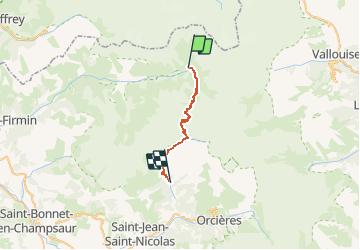
Parc des Écrins Nord/Sud

mpstoop
User

Length
22 km

Max alt
2604 m

Uphill gradient
1322 m
Km-Effort
40 km

Min alt
1271 m

Downhill gradient
1486 m
Boucle
No
Creation date :
2020-01-03 14:06:28.455
Updated on :
2020-01-04 17:47:16.198
7h56
Difficulty : Very difficult

FREE GPS app for hiking
 SityTrail
IGN / Geographical institutes
SityTrail Plus
The world is yours!
About
Trail Walking of 22 km to be discovered at Provence-Alpes-Côte d'Azur, Hautes-Alpes, La Chapelle-en-Valgaudémar. This trail is proposed by mpstoop.
Description
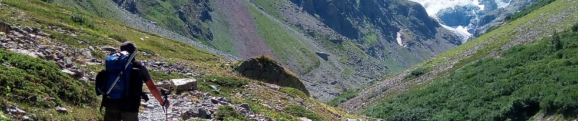
Marche en altitude sur rochers, névés, bord de glaciers . Faune notable : bouquetin, chamois, vautour moine, gypaète barbu, passage de loups..
Photos


Positioning
Country:
France
Region :
Provence-Alpes-Côte d'Azur
Department/Province :
Hautes-Alpes
Municipality :
La Chapelle-en-Valgaudémar
Location:
Unknown
Start:(Dec)
Start:(UTM)
285292 ; 4967862 (32T) N.
Comments